
Fitxategi:SinoKorea Friendship Bridge.jpg
Aurreikuspen honen neurria: 800 × 600 pixel. Bestelako bereizmenak: 320 × 240 pixel | 640 × 480 pixel | 1.024 × 768 pixel | 1.280 × 960 pixel | 2.048 × 1.536 pixel.
Bereizmen handikoa ((2.048 × 1.536 pixel, fitxategiaren tamaina: 1,34 MB, MIME mota: image/jpeg))
Fitxategi hau Wikimedia Commonsekoa da. Hango deskribapen orriko informazioa behean duzu. |
Laburpena
| Deskribapena |
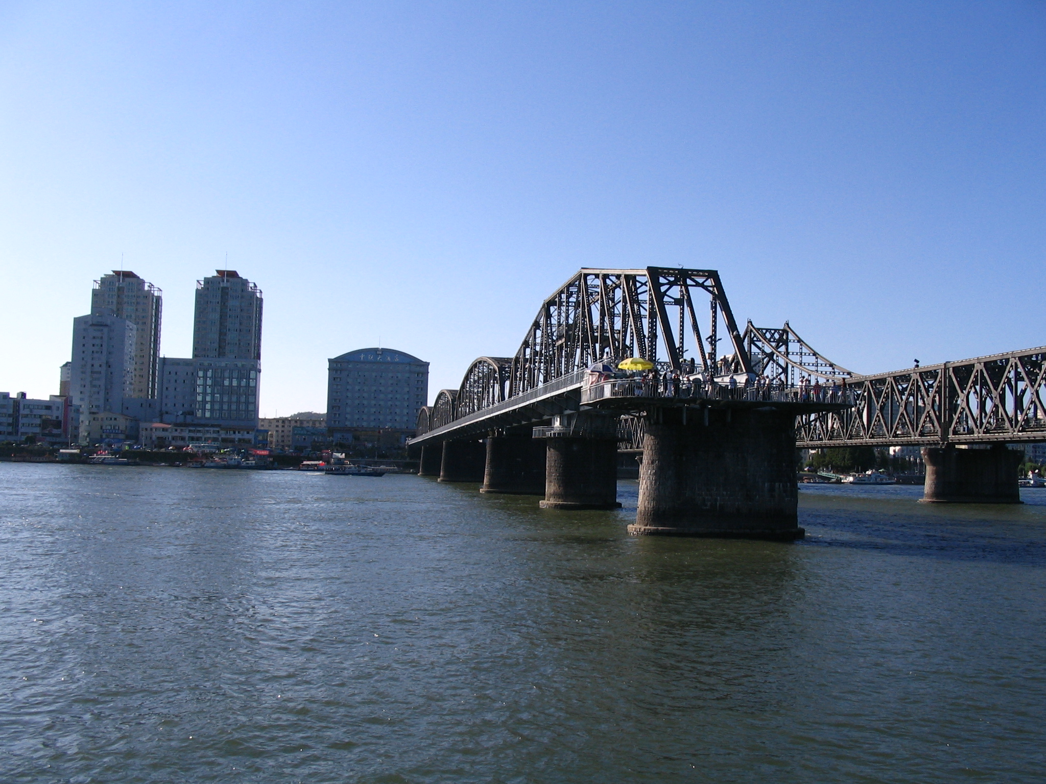
English: View of Dandong from North Korean bank of the Yalu River, with the Yalu River Broken Bridge and the China-Korea Friendship Bridge. At the south end of the Yalu River Broken Bridge, a former railway bridge that once connected China and North Korea until part of the bridge was destroyed, a viewing platform has been constructed. The parallel Sino-Korean Friendship Bridge, to the right, still connects the two countries. |
| Data | |
| Jatorria | Bridge destroyed by Americans |
| Egilea | serapio |
| Kameraren kokapena | | Irudi hau eta gehiago beraien kokapenekin hurrengo lekuetan: OpenStreetMap |
|---|
Lizentzia
This file is licensed under the Creative Commons Attribution-Share Alike 2.0 Generic license.
- Askea zara:
- partekatzeko – lana kopiatzeko, banatzeko eta bidaltzeko
- birnahasteko – lana moldatzeko
- Ondorengo baldintzen pean:
- eskuduntza – Egiletza behar bezala aitortu behar duzu, lizentzia ikusteko esteka gehitu, eta ea aldaketak egin diren aipatu. Era egokian egin behar duzu hori guztia, baina inola ere ez egileak zure lana edo zure erabilera babesten duela irudikatuz.
- berdin partekatu – Lan honetan oinarrituta edo aldatuta berria eraikitzen baduzu, emaitza lana hau bezalako lizentzia batekin argitaratu behar duzu.
| This image was originally posted to Flickr by serapio at https://www.flickr.com/photos/22353973@N00/1391134312. It was reviewed on 2007ko irailaren 19a by FlickreviewR and was confirmed to be licensed under the terms of the cc-by-sa-2.0. |
Fitxategiaren historia
Data/orduan klik egin fitxategiak orduan zuen itxura ikusteko.
| Data/Ordua | Iruditxoa | Neurriak | Erabiltzailea | Iruzkina | |
|---|---|---|---|---|---|
| oraingoa | 18:33, 11 martxoa 2024 | | 2.048 × 1.536 (1,34 MB) | VulpesVulpes42 | Higher resolution. |
| 21:08, 18 iraila 2007 |  | 1.024 × 768 (411 KB) | Jklamo | {{Information |Description= View of Dandong from North Korean bank of the Yalu River with China-Korea Friendship Bridge |Source=[http://www.flickr.com/photos/22353973@N00/1391134312/ Bridge destroyed by Americans] |Date=August 22, 2007 at 16:13 |Author=[h |
Irudira dakarten loturak
Ez dago fitxategi hau darabilen orririk.
Fitxategiaren erabilera orokorra
Hurrengo beste wikiek fitxategi hau darabilte:
- bn.wikipedia.org proiektuan duen erabilera
- ca.wikipedia.org proiektuan duen erabilera
- da.wikipedia.org proiektuan duen erabilera
- en.wikipedia.org proiektuan duen erabilera
- es.wikipedia.org proiektuan duen erabilera
- fa.wikipedia.org proiektuan duen erabilera
- fr.wikipedia.org proiektuan duen erabilera
- he.wikipedia.org proiektuan duen erabilera
- hy.wikipedia.org proiektuan duen erabilera
- id.wikipedia.org proiektuan duen erabilera
- ja.wikipedia.org proiektuan duen erabilera
- ko.wikipedia.org proiektuan duen erabilera
- lt.wikipedia.org proiektuan duen erabilera
- nds.wikipedia.org proiektuan duen erabilera
- nl.wikipedia.org proiektuan duen erabilera
- no.wikipedia.org proiektuan duen erabilera
- pl.wikipedia.org proiektuan duen erabilera
- pt.wikipedia.org proiektuan duen erabilera
- ru.wikipedia.org proiektuan duen erabilera
- sv.wikipedia.org proiektuan duen erabilera
- th.wikipedia.org proiektuan duen erabilera
- tr.wikipedia.org proiektuan duen erabilera
- uz.wikipedia.org proiektuan duen erabilera
- vi.wikipedia.org proiektuan duen erabilera
- www.wikidata.org proiektuan duen erabilera
- zh.wikipedia.org proiektuan duen erabilera