
Fitxategi:Smnx frcast map hires.jpg

Aurreikuspen honen neurria: 470 × 600 pixel. Bestelako bereizmenak: 188 × 240 pixel | 376 × 480 pixel | 602 × 768 pixel | 802 × 1.024 pixel | 2.160 × 2.757 pixel.
Bereizmen handikoa ((2.160 × 2.757 pixel, fitxategiaren tamaina: 2,4 MB, MIME mota: image/jpeg))
Fitxategi hau Wikimedia Commonsekoa da. Hango deskribapen orriko informazioa behean duzu. |
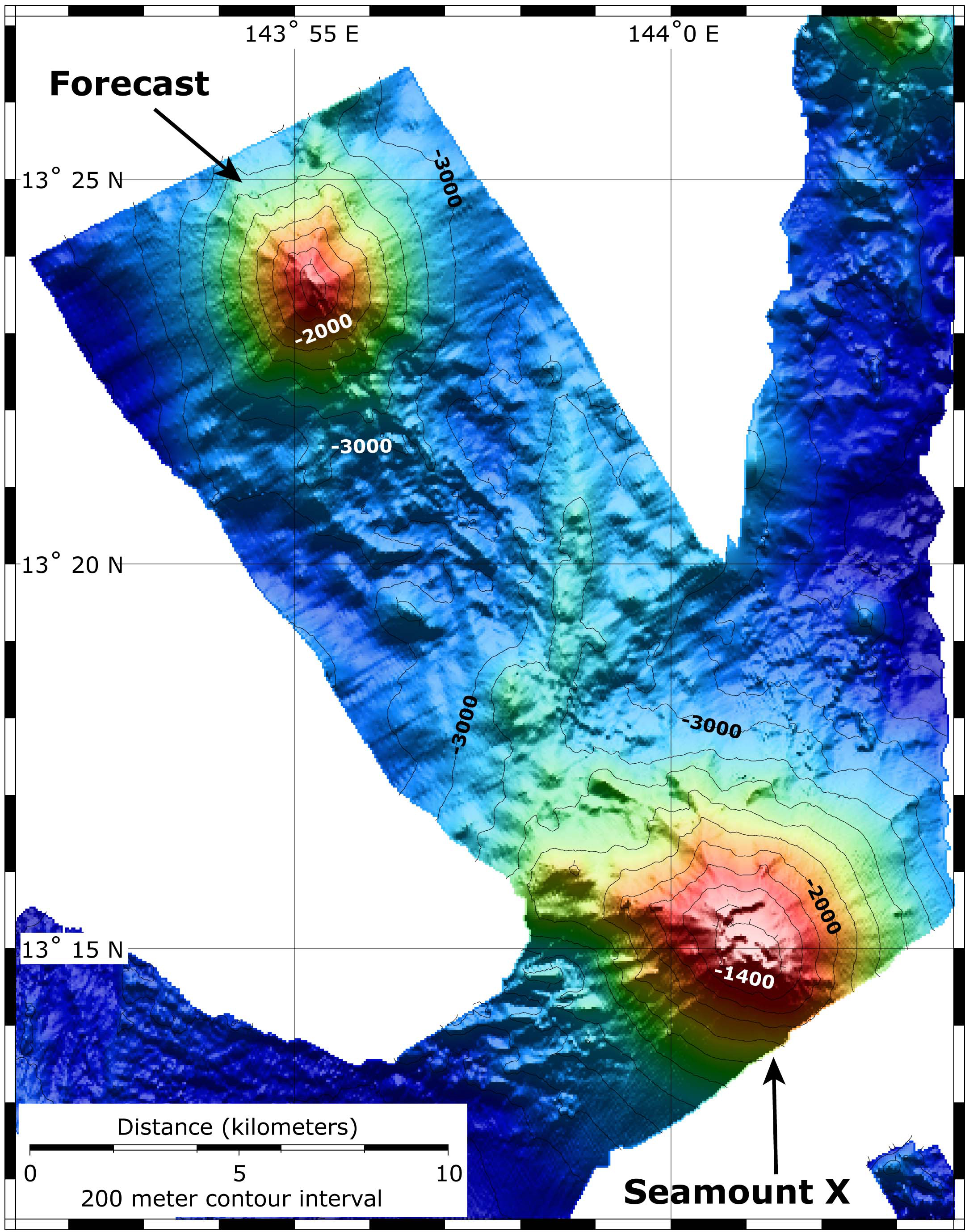
| Deskribapena | Map showing the location and topography of Seamount X and Forecast. The bathymetry data are a combination of EM300 bathymetry collected on the SRoF'04 expedition, and SeaBeam bathymetry collected on this expedition, just prior to diving on Forecast. |
| Data | |
| Jatorria | http://oceanexplorer.noaa.gov/explorations/06fire/logs/hires/smnx_frcast_map_hires.jpg |
| Egilea | NOAA |
| Lizentzia (Fitxategi hau berrerabiltzen) |
PD |
This image is in the public domain because it contains materials that originally came from the U.S. National Oceanic and Atmospheric Administration, taken or made as part of an employee's official duties.
|
Fitxategiaren historia
Data/orduan klik egin fitxategiak orduan zuen itxura ikusteko.
| Data/Ordua | Iruditxoa | Neurriak | Erabiltzailea | Iruzkina | |
|---|---|---|---|---|---|
| oraingoa | 13:13, 28 otsaila 2008 | | 2.160 × 2.757 (2,4 MB) | Peko | {{Information |Description=Map showing the location and topography of Seamount X and Forecast. The bathymetry data are a combination of EM300 bathymetry collected on the SRoF'04 expedition, and SeaBeam bathymetry collected on this expedition, just prior t |
Irudira dakarten loturak
Hurrengo orrialdeek dute fitxategi honetarako lotura:
Fitxategiaren erabilera orokorra
Hurrengo beste wikiek fitxategi hau darabilte:
- pt.wikipedia.org proiektuan duen erabilera
- sk.wikipedia.org proiektuan duen erabilera
- www.wikidata.org proiektuan duen erabilera