
Fitxategi:St Dominick Church - geograph.org.uk - 291865.jpg
Ez dago bereizmen handiagorik.
St_Dominick_Church_-_geograph.org.uk_-_291865.jpg ((640 × 426 pixel, fitxategiaren tamaina: 128 KB, MIME mota: image/jpeg))
Fitxategi hau Wikimedia Commonsekoa da. Hango deskribapen orriko informazioa behean duzu. |
Laburpena
| Deskribapena |
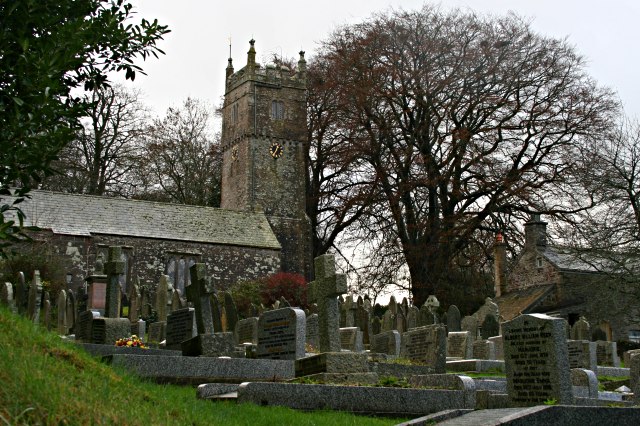
English: St Dominick Church The church dates from 1259 and underwent major restoration in the mid 19th century.
I understand that the parish name is sometimes spelt "St Dominic", without the final K and that there is a move to make this official. I use the "ck" ending here as that is how it is shown on the Ordnance Survey map. |
| Data | |
| Jatorria | From geograph.org.uk |
| Egilea | Tony Atkin |
| Aitortu (required by the license) | Tony Atkin / St Dominick Church / |
| Objektuaren kokapena | | Irudi hau eta gehiago beraien kokapenekin hurrengo lekuetan: OpenStreetMap |
|---|
_heading:180.00&language=eu)
Lizentzia

|
This image was taken from the Geograph project collection. See this photograph's page on the Geograph website for the photographer's contact details. The copyright on this image is owned by Tony Atkin and is licensed for reuse under the Creative Commons Attribution-ShareAlike 2.0 license.
|
This file is licensed under the Creative Commons Attribution-Share Alike 2.0 Generic license.
Aitortu: Tony Atkin
- Askea zara:
- partekatzeko – lana kopiatzeko, banatzeko eta bidaltzeko
- birnahasteko – lana moldatzeko
- Ondorengo baldintzen pean:
- eskuduntza – Egiletza behar bezala aitortu behar duzu, lizentzia ikusteko esteka gehitu, eta ea aldaketak egin diren aipatu. Era egokian egin behar duzu hori guztia, baina inola ere ez egileak zure lana edo zure erabilera babesten duela irudikatuz.
- berdin partekatu – Lan honetan oinarrituta edo aldatuta berria eraikitzen baduzu, emaitza lana hau bezalako lizentzia batekin argitaratu behar duzu.
Fitxategiaren historia
Data/orduan klik egin fitxategiak orduan zuen itxura ikusteko.
| Data/Ordua | Iruditxoa | Neurriak | Erabiltzailea | Iruzkina | |
|---|---|---|---|---|---|
| oraingoa | 23:55, 14 abendua 2010 | | 640 × 426 (128 KB) | GeographBot | == {{int:filedesc}} == {{Information |description={{en|1=St Dominick Church The church dates from 1259 and underwent major restoration in the mid 19th century. I understand that the parish name is sometimes spelt "St Dominic", without the final K and t |
Irudira dakarten loturak
Hurrengo orrialdeek dute fitxategi honetarako lotura:
Fitxategiaren erabilera orokorra
Hurrengo beste wikiek fitxategi hau darabilte:
- dag.wikipedia.org proiektuan duen erabilera
- de.wikipedia.org proiektuan duen erabilera
- en.wikipedia.org proiektuan duen erabilera
- fa.wikipedia.org proiektuan duen erabilera
- www.wikidata.org proiektuan duen erabilera