
Fitxategi:Stoner Site fields.jpg

Aurreikuspen honen neurria: 800 × 600 pixel. Bestelako bereizmenak: 320 × 240 pixel | 640 × 480 pixel | 1.024 × 768 pixel | 1.280 × 960 pixel | 2.560 × 1.920 pixel | 2.816 × 2.112 pixel.
Bereizmen handikoa ((2.816 × 2.112 pixel, fitxategiaren tamaina: 3,15 MB, MIME mota: image/jpeg))
Fitxategi hau Wikimedia Commonsekoa da. Hango deskribapen orriko informazioa behean duzu. |
|
This is an image of a place or building that is listed on the National Register of Historic Places in the United States of America. Its reference number is 78001143. |
| Kameraren kokapena | | Irudi hau eta gehiago beraien kokapenekin hurrengo lekuetan: OpenStreetMap |
|---|
| Deskribapena |
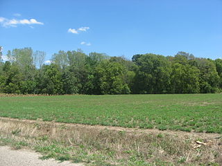
English: Overview of a field at the Stoner Site, located along the eastern side of 1550th Street between 1300th and 1235th Avenues in Lamotte Township, Crawford County, Illinois, United States. Stoner was the location of a village of the Allison-LaMotte culture of Native Americans during the Woodland period; today, it is an archaeological site and listed on the National Register of Historic Places. |
||
| Data | Taken on 2012ko abuztuaren 18a | ||
| Jatorria | Norberak egina | ||
| Egilea | Nyttend | ||
| Lizentzia (Fitxategi hau berrerabiltzen) |
|
Fitxategiaren historia
Data/orduan klik egin fitxategiak orduan zuen itxura ikusteko.
| Data/Ordua | Iruditxoa | Neurriak | Erabiltzailea | Iruzkina | |
|---|---|---|---|---|---|
| oraingoa | 13:56, 5 urria 2012 | | 2.816 × 2.112 (3,15 MB) | Nyttend | {{NRHP|78001143}} {{Location|39|2|18|N|87|39|20|W}} {{Information |Description={{en|Overview of a field at the {{w|Stoner Site}}, located along the eastern side of 1550th Street between 1300th and 1235th Avenues in {{w|Lamotte Township, Crawford County... |
Irudira dakarten loturak
Hurrengo orrialdeek dute fitxategi honetarako lotura:
Fitxategiaren erabilera orokorra
Hurrengo beste wikiek fitxategi hau darabilte:
- cy.wikipedia.org proiektuan duen erabilera
- de.wikipedia.org proiektuan duen erabilera
- en.wikipedia.org proiektuan duen erabilera
- es.wikipedia.org proiektuan duen erabilera
- fa.wikipedia.org proiektuan duen erabilera
- fr.wikipedia.org proiektuan duen erabilera
- ur.wikipedia.org proiektuan duen erabilera
- vi.wikipedia.org proiektuan duen erabilera
- www.wikidata.org proiektuan duen erabilera