
Fitxategi:Tempelhofer Ufer B-Kreuzberg 06-2017 img2.jpg

Aurreikuspen honen neurria: 800 × 500 pixel. Bestelako bereizmenak: 320 × 200 pixel | 640 × 400 pixel | 1.024 × 640 pixel | 1.280 × 800 pixel | 2.560 × 1.600 pixel | 4.513 × 2.820 pixel.
Bereizmen handikoa ((4.513 × 2.820 pixel, fitxategiaren tamaina: 5,79 MB, MIME mota: image/jpeg))
Fitxategi hau Wikimedia Commonsekoa da. Hango deskribapen orriko informazioa behean duzu. |
| Deskribapena |
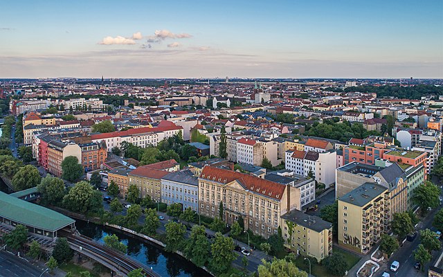
English: Aerial photo of Tempelhofer Ufer in Berlin (Germany)
Deutsch: Luftaufnahme vom Tempelhofer Ufer in Berlin (Deutschland)
Русский: Аэрофотосъёмка набережной Темпельхофер-уфер в Берлине (Германия) |
| Data | |
| Jatorria | Norberak egina |
| Egilea | A.Savin |
| Lizentzia (Fitxategi hau berrerabiltzen) |
.svg) Just attribute the author: «A.Savin, Wikipedia»; if you have questions — Telegram, or e-mail to wikiphotospace@gmail.com..svg) Просто укажите в качестве автора: «А.Савин, Википедия»; если есть вопрос — телеграм, или эл.почта на wikiphotospace@gmail.com. Kennzeichnen Sie einfach als Autor: «A.Savin, Wikipedia»; falls Sie Fragen haben — Telegram, oder E-Mail an wikiphotospace@gmail.com.
Thank you. |
| Kameraren kokapena | | Irudi hau eta gehiago beraien kokapenekin hurrengo lekuetan: OpenStreetMap |
|---|
Lizentzia
| Copyleft: This work of art is free; you can redistribute it and/or modify it according to terms of the Free Art License. You will find a specimen of this license on the Copyleft Attitude site as well as on other sites. |
Fitxategiaren historia
Data/orduan klik egin fitxategiak orduan zuen itxura ikusteko.
| Data/Ordua | Iruditxoa | Neurriak | Erabiltzailea | Iruzkina | |
|---|---|---|---|---|---|
| oraingoa | 23:15, 19 urria 2017 | | 4.513 × 2.820 (5,79 MB) | A.Savin | {{User:A.Savin/F |Description= {{en|Aerial photo of Tempelhofer Ufer in Berlin (Germany)}} {{de|Luftaufnahme vom Tempelhofer Ufer in Berlin (Deutschland)}} {{ru|Аэрофотосъёмка набережной Темпельхофер-уфер в Бе... |
Irudira dakarten loturak
Hurrengo orrialdeek dute fitxategi honetarako lotura:
Fitxategiaren erabilera orokorra
Hurrengo beste wikiek fitxategi hau darabilte:
- ca.wikipedia.org proiektuan duen erabilera
- ceb.wikipedia.org proiektuan duen erabilera
- cs.wikipedia.org proiektuan duen erabilera
- cy.wikipedia.org proiektuan duen erabilera
- de.wikipedia.org proiektuan duen erabilera
- en.wikipedia.org proiektuan duen erabilera
- eo.wikipedia.org proiektuan duen erabilera
- he.wikipedia.org proiektuan duen erabilera
- it.wikipedia.org proiektuan duen erabilera
- it.wikivoyage.org proiektuan duen erabilera
- nl.wikipedia.org proiektuan duen erabilera
- no.wikipedia.org proiektuan duen erabilera
- ru.wikinews.org proiektuan duen erabilera
- tg.wikipedia.org proiektuan duen erabilera
- tl.wikipedia.org proiektuan duen erabilera
- tr.wikipedia.org proiektuan duen erabilera
- www.wikidata.org proiektuan duen erabilera
- zh.wikipedia.org proiektuan duen erabilera