
Fitxategi:The road through Mithian Downs - geograph.org.uk - 62565.jpg
Ez dago bereizmen handiagorik.
The_road_through_Mithian_Downs_-_geograph.org.uk_-_62565.jpg ((640 × 387 pixel, fitxategiaren tamaina: 89 KB, MIME mota: image/jpeg))
Fitxategi hau Wikimedia Commonsekoa da. Hango deskribapen orriko informazioa behean duzu. |
Laburpena
| Deskribapena |
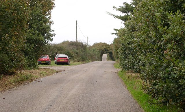
English: The road through Mithian Downs. This minor road runs along the top of the Mithian Downs ridge. It is long and straight and seems to encourage motorists to drive fast, it is not however, heavily used. The Ordnance Survey 1:25,000 map shows a green lane to the east which could be an alternative for the walker, cyclist or horserider. Unfortunately it seems to be completely overgrown and unusable. |
| Data | |
| Jatorria | From geograph.org.uk |
| Egilea | Tony Atkin |
| Aitortu (required by the license) | Tony Atkin / The road through Mithian Downs / |
| Kameraren kokapena | | Irudi hau eta gehiago beraien kokapenekin hurrengo lekuetan: OpenStreetMap |
|---|
_&language=eu)
| Objektuaren kokapena | | Irudi hau eta gehiago beraien kokapenekin hurrengo lekuetan: OpenStreetMap |
|---|
_&language=eu)
Lizentzia

|
This image was taken from the Geograph project collection. See this photograph's page on the Geograph website for the photographer's contact details. The copyright on this image is owned by Tony Atkin and is licensed for reuse under the Creative Commons Attribution-ShareAlike 2.0 license.
|
This file is licensed under the Creative Commons Attribution-Share Alike 2.0 Generic license.
Aitortu: Tony Atkin
- Askea zara:
- partekatzeko – lana kopiatzeko, banatzeko eta bidaltzeko
- birnahasteko – lana moldatzeko
- Ondorengo baldintzen pean:
- eskuduntza – Egiletza behar bezala aitortu behar duzu, lizentzia ikusteko esteka gehitu, eta ea aldaketak egin diren aipatu. Era egokian egin behar duzu hori guztia, baina inola ere ez egileak zure lana edo zure erabilera babesten duela irudikatuz.
- berdin partekatu – Lan honetan oinarrituta edo aldatuta berria eraikitzen baduzu, emaitza lana hau bezalako lizentzia batekin argitaratu behar duzu.
Fitxategiaren historia
Data/orduan klik egin fitxategiak orduan zuen itxura ikusteko.
| Data/Ordua | Iruditxoa | Neurriak | Erabiltzailea | Iruzkina | |
|---|---|---|---|---|---|
| oraingoa | 22:03, 30 urtarrila 2010 | | 640 × 387 (89 KB) | GeographBot | == {{int:filedesc}} == {{Information |description={{en|1=The road through Mithian Downs. This minor road runs along the top of the Mithian Downs ridge. It is long and straight and seems to encourage motorists to drive fast, it is not however, heavily use |
Irudira dakarten loturak
Hurrengo orrialdeek dute fitxategi honetarako lotura:
Fitxategiaren erabilera orokorra
Hurrengo beste wikiek fitxategi hau darabilte:
- en.wikipedia.org proiektuan duen erabilera
- www.wikidata.org proiektuan duen erabilera