
Fitxategi:Map of Ireland's capitals.png

Aurreikuspen honen neurria: 470 × 599 pixel. Bestelako bereizmenak: 188 × 240 pixel | 376 × 480 pixel | 602 × 768 pixel | 803 × 1.024 pixel | 1.630 × 2.078 pixel.
Bereizmen handikoa ((1.630 × 2.078 pixel, fitxategiaren tamaina: 136 KB, MIME mota: image/png))
Fitxategi hau Wikimedia Commonsekoa da. Hango deskribapen orriko informazioa behean duzu. |
Laburpena

|
Irudi hau birsortu beharko litzateke SVG irudi bektorial moduan. Honek abantaila asko ematen ditu, ikus Commons:Media for cleanup (ingelesez) informazio gehiagorako. Irudi honen SVG bertsioa eskuragarri badago, mesedez Commonsera igo. Igo ostean, ordezkatu txantiloi hau txantiloi honegatik {{vector version available|irudiaren izen berria.svg}} irudi honetan.
|
| Deskribapena |
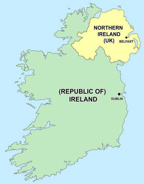
English: Political capitals of the countries Ireland and Northern Ireland Bahasa Indonesia: Ibu kota dari negara Irlandia Utara (Belfast) dan Republik Irlandia (Dublin) |
| Data | 2006ko abenduaren 26a (Jatorrizko igoera-data) |
| Jatorria | Transferred from en.wikipedia to Commons by Kajasudhakarababu using CommonsHelper. |
| Egilea | The original uploader was Jonto at ingelesa Wikipedia. |
Lizentzia
| Fitxategi hau Creative Commons Attribution-Share Alike 3.0 Unported lizentziapean dago. Subject to disclaimers. | ||
| ||
| This licensing tag was added to this file as part of the GFDL licensing update. |

|
Baimena duzu dokumentu hau kopiatu, banatu edo/eta aldatzeko GNU Free Documentation License baldintzapean, Free Software Foundationek argitaratutako 1.2 edo ondorengo bertsioan; sekzio aldaezinik gabe, azaleko testurik gabe, eta atzeko azaleko testurik gabe. Lizentziaren kopia dago GNU Free Documentation License izenburudun atalean. Subject to disclaimers. |
Jatorrizko igoera erregistroa
- delete all current 21:50, 26 December 2006 Thumbnail for version as of 21:50, 26 December 2006 415×541 (13 KB) Jonto (Talk | contribs | block) (Updated as per talk.)
- delete revert 13:42, 11 October 2006 Thumbnail for version as of 13:42, 11 October 2006 415×541 (11 KB) Evertype (Talk | contribs | block) (I re-coloured the existing map and replaced the text on the island.)
- delete revert 04:08, 11 January 2006 Thumbnail for version as of 04:08, 11 January 2006 415×541 (5 KB) Zscout370 (Talk | contribs | block) (Compression)
- delete revert 07:31, 31 May 2005 Thumbnail for version as of 07:31, 31 May 2005 415×541 (14 KB) WikiDon (Talk | contribs | block)
en:Category:Maps of Northern Ireland
Fitxategiaren historia
Data/orduan klik egin fitxategiak orduan zuen itxura ikusteko.
| Data/Ordua | Iruditxoa | Neurriak | Erabiltzailea | Iruzkina | |
|---|---|---|---|---|---|
| oraingoa | 16:22, 5 uztaila 2015 | | 1.630 × 2.078 (136 KB) | Cmdrjameson | Compressed with pngout. Reduced by 93kB (40% decrease). |
| 02:11, 19 iraila 2014 |  | 1.630 × 2.078 (229 KB) | Wiki01916 | Improved text legibility and colour as per Map Maker best practises guide. | |
| 03:01, 9 abendua 2013 |  | 804 × 1.023 (125 KB) | Asarlaí | Reverted to version as of 12 August 2012. This has much clearer writing, shows the border more clearly, shows the size of the capitals more accurately, and has a more neutral color for NI | |
| 12:26, 16 iraila 2013 |  | 817 × 1.042 (106 KB) | Setanta Saki | Minor fix | |
| 08:58, 16 iraila 2013 |  | 817 × 1.042 (105 KB) | Setanta Saki | minor fix | |
| 08:44, 16 iraila 2013 |  | 817 × 1.042 (104 KB) | Setanta Saki | Update with higher quality map and titles | |
| 18:22, 5 abuztua 2013 |  | 804 × 1.023 (113 KB) | SonofSetanta | Lifting colour of Northern Ireland away from Green - more neutral. | |
| 21:47, 12 abuztua 2012 |  | 804 × 1.023 (125 KB) | Asarlaí | ||
| 15:41, 17 maiatza 2012 |  | 415 × 541 (8 KB) | HighKing | Reverted to version as of 13:46, 1 May 2011 This is a political map. As per IMOS and IRE-IRL , use correct names. | |
| 06:44, 31 uztaila 2011 |  | 415 × 541 (13 KB) | BoutYeBigLad | For clarity. The map does NOT clearly dispel any confusion as it is not made clear that Ireland has been primarily the name of the island for hundreds of years.. |
Irudira dakarten loturak
Hurrengo orrialdeek dute fitxategi honetarako lotura:
Fitxategiaren erabilera orokorra
Hurrengo beste wikiek fitxategi hau darabilte:
- ar.wikipedia.org proiektuan duen erabilera
- arz.wikipedia.org proiektuan duen erabilera
- ast.wikipedia.org proiektuan duen erabilera
- be-tarask.wikipedia.org proiektuan duen erabilera
- bg.wikipedia.org proiektuan duen erabilera
- bs.wikipedia.org proiektuan duen erabilera
- ca.wikipedia.org proiektuan duen erabilera
- cs.wikipedia.org proiektuan duen erabilera
- da.wikipedia.org proiektuan duen erabilera
- el.wikipedia.org proiektuan duen erabilera
- en.wikipedia.org proiektuan duen erabilera
- The Troubles
- Talk:Westminster system
- Talk:Casimir III the Great
- Talk:Ivory Coast/Archive 1
- Talk:Tartar sauce
- Talk:Patrick Pearse/Archive 1
- Talk:Pope Paul VI/Archive 1
- User talk:Bernfarr
- Talk:Paul Martin
- User:Jtdirl
- Talk:Culture of New Zealand/Archive 1
- User talk:Michael Hardy/Archive2
- Talk:Irish Free State
- Talk:Empress Elisabeth of Austria
- Talk:North Macedonia/Archive 7
- Talk:Nelson, New Zealand
- Talk:James VI and I/Archive 1
- Talk:Prime minister/Archive 1
- Talk:Charlotte of Belgium
- Talk:Lucian Pulvermacher
- Talk:Patrice de MacMahon
- Talk:First lady
- Talk:Loyalism
- Talk:Parliament House, Dublin
- Talk:Mary Robinson
- History of the Republic of Ireland
- User talk:Karl Schalike
- Talk:John O'Connor (cardinal)
- Talk:Swiss Guards
- Talk:Geraldine of Albania
- Talk:Monarchy of Canada/Archive 2
- Talk:Duarte Pio, Duke of Braganza
- User talk:Gidonb/Archive 2005
- User talk:Lunkwill
Ikus fitxategi honen erabilpen global gehiago.