
Fitxategi:1852 Bocage Map of Australia and Polynesia - Geographicus - Oceanie-bocage-1852.jpg

Bereizmen handikoa ((3.000 × 2.210 pixel, fitxategiaren tamaina: 2,19 MB, MIME mota: image/jpeg))
Fitxategi hau Wikimedia Commonsekoa da. Hango deskribapen orriko informazioa behean duzu. |
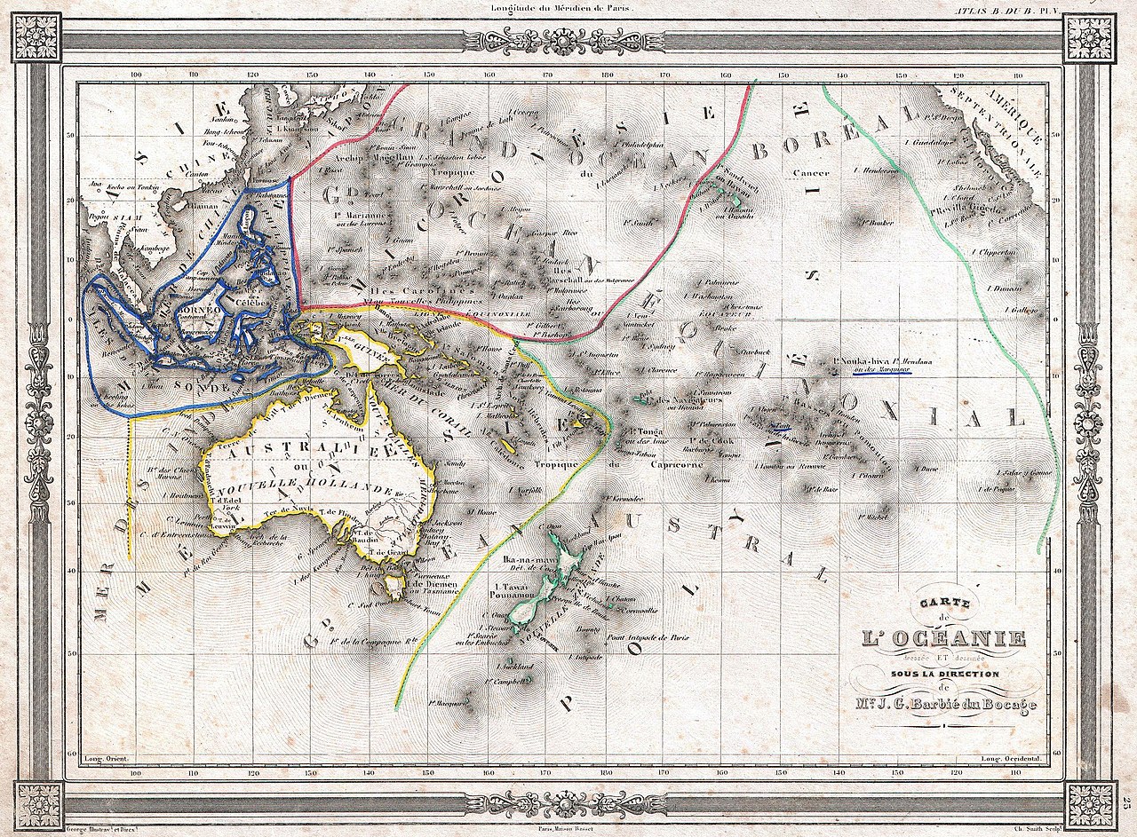
| Carte de l'Océanie dressée et dessinée sous la direction de Mr. J. G. Barbié du Bocage. | ||||||
|---|---|---|---|---|---|---|
| Artista | ||||||
| Izenburua |
Carte de l'Océanie dressée et dessinée sous la direction de Mr. J. G. Barbié du Bocage. |
|||||
| Deskribapena |
English: An uncommon and extremely attractive 1852 map of Oceania by J. G. Barbié du Bocage. Includes Australia, New Zealand, Polynesia, Micronesia, Melanesia and Malaysia. Australia is described as “pays inconnu” and alternately labeled “New Holland”. Hawaii shown as the “Sandwich Islands”. Features a beautiful frame style border. Prepared by J. G. Barbié du Bocage for publication as plate no. 25 in Maison Basset’s 1852 edition of the Atlas illustré . |
|||||
| Data | 1852 (undated) | |||||
| Neurriak | altuera: 9 in (22,8 cm); Zabalera: 12,5 in (31,7 cm) | |||||
| Erregistro-zenbakia |
Geographicus link: Oceanie-bocage-1852 |
|||||
| Jatorria/Argazkilaria |
Maison Basset, Atlas Illustré, (1852 issue).
|
|||||
| Lizentzia (Fitxategi hau berrerabiltzen) |
|
|||||
Fitxategiaren historia
Data/orduan klik egin fitxategiak orduan zuen itxura ikusteko.
| Data/Ordua | Iruditxoa | Neurriak | Erabiltzailea | Iruzkina | |
|---|---|---|---|---|---|
| oraingoa | 21:13, 22 martxoa 2011 | | 3.000 × 2.210 (2,19 MB) | BotMultichillT | {{subst:User:Multichill/Geographicus |link=http://www.geographicus.com/P/AntiqueMap/Oceanie-bocage-1852 |product_name=1852 Bocage Map of Australia and Polynesia |map_title=Carte de L'Oceanie dressee ET dessinee sous laDirection de Mr. J. G. Barbie du Boca |
Irudira dakarten loturak
Hurrengo orrialdeek dute fitxategi honetarako lotura:
Fitxategiaren erabilera orokorra
Hurrengo beste wikiek fitxategi hau darabilte:
- af.wikipedia.org proiektuan duen erabilera
- ar.wikipedia.org proiektuan duen erabilera
- بوابة:التاريخ الإسلامي/بوابات شقيقة
- تصنيف:تاريخ أوقيانوسيا
- المعاهدة الألمانية الإسبانية لعام 1899
- جون مكدوال ستيوارت
- تشارلز ستورت
- أبل تاسمان
- ماثيو فليندرز
- قالب:شريط بوابات
- قالب:شريط بوابات/شرح
- تاريخ أوقيانوسيا
- تاريخ نيوزيلندا
- وحدة:Portal/images/ت
- تصنيف:بوابة تاريخ أوقيانوسيا/مقالات متعلقة
- وحدة:Portal/images/ت/شرح
- تاريخ جزر المحيط الهادئ
- هولندا الجديدة (أستراليا)
- تمرد مداني كاسل هيل
- تاريخ أستراليا منذ 1945
- الاستكشاف الأوروبي البحري لأستراليا
- الاتفاقية الثلاثية
- تاريخ بابوا غينيا الجديدة
- مصادرات الأراضي في نيوزيلندا
- تاريخ نيو ساوث ويلز
- شركة نيوزيلندا
- تمرد ويلكوكس 1895
- تصنيف:تاريخ أستراليا منذ 1945
- تصنيف:تشارلز ستورت
- دومينيون نيوزيلندا
- علم الآثار في نيوزيلندا
- تاريخ الماوري
- إقليم غينيا الجديدة
- ثقافة سكان أستراليا الأصليين
- مجزرة كونيستون
- نظريات استيطان نيوزيلندا قبل وصول الماوريون
- تاريخ أستراليا الغربية
- ary.wikipedia.org proiektuan duen erabilera
- bn.wikipedia.org proiektuan duen erabilera
- cbk-zam.wikipedia.org proiektuan duen erabilera
- en.wikipedia.org proiektuan duen erabilera
- fr.wikipedia.org proiektuan duen erabilera
- fr.wiktionary.org proiektuan duen erabilera
Ikus fitxategi honen erabilpen global gehiago.