
Fitxategi:Klimagürtel-der-erde-tundra.png
Aurreikuspen honen neurria: 800 × 400 pixel. Bestelako bereizmenak: 320 × 160 pixel | 640 × 320 pixel | 1.024 × 512 pixel | 1.280 × 640 pixel | 3.600 × 1.800 pixel.
Bereizmen handikoa ((3.600 × 1.800 pixel, fitxategiaren tamaina: 678 KB, MIME mota: image/png))
Fitxategi hau Wikimedia Commonsekoa da. Hango deskribapen orriko informazioa behean duzu. |
Laburpena
| Deskribapena |
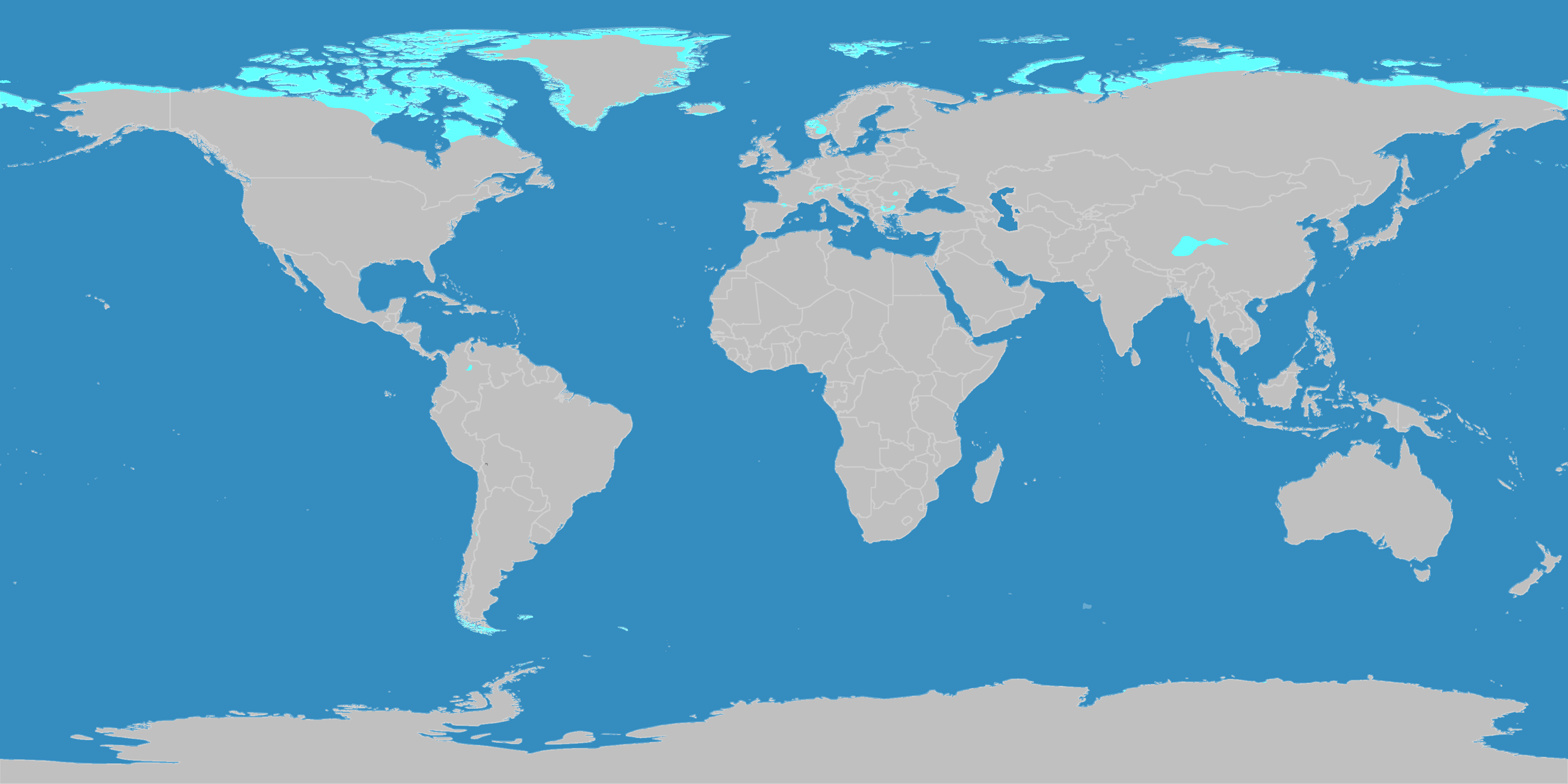
English: This map shows the Earth zones with a polar tundra climate. Deutsch: Diese Karte stellt die Tundrenzone der Erde dar. |
| Data | |
| Jatorria |
English: Own work on the basis of the following data: Deutsch: Selbst erstellt auf Basis dieser Geodaten:
|
| Egilea | LordToran |
| Lizentzia (Fitxategi hau berrerabiltzen) |
|
| Beste bertsioak |
 |
Lizentzia
Fitxategi hau Creative Commons Attribution-Share Alike 3.0 Unported lizentziapean dago.
- Askea zara:
- partekatzeko – lana kopiatzeko, banatzeko eta bidaltzeko
- birnahasteko – lana moldatzeko
- Ondorengo baldintzen pean:
- eskuduntza – Egiletza behar bezala aitortu behar duzu, lizentzia ikusteko esteka gehitu, eta ea aldaketak egin diren aipatu. Era egokian egin behar duzu hori guztia, baina inola ere ez egileak zure lana edo zure erabilera babesten duela irudikatuz.
- berdin partekatu – Lan honetan oinarrituta edo aldatuta berria eraikitzen baduzu, emaitza lana hau bezalako lizentzia batekin argitaratu behar duzu.
Fitxategiaren historia
Data/orduan klik egin fitxategiak orduan zuen itxura ikusteko.
| Data/Ordua | Iruditxoa | Neurriak | Erabiltzailea | Iruzkina | |
|---|---|---|---|---|---|
| oraingoa | 23:09, 11 urria 2016 | | 3.600 × 1.800 (678 KB) | Maphobbyist | The Caspian Sea was omitted. The Köppen system is based on the concept that climate types are correlated with the natural vegetation. |
| 17:28, 15 urria 2007 |  | 3.600 × 1.800 (573 KB) | Lortordermur | ||
| 22:50, 5 ekaina 2007 |  | 3.445 × 1.731 (621 KB) | Lortordermur | == Beschreibung == {{Information |Description=Diese Karte stellt die Tundrenzone der Erde dar. |Source=Selbst erstellt auf Basis [http://www.copernicus.org/EGU/hess/hessd/4/439/hessd-4-439.htm dieser Karte], welche unter einer Creative-Commons-Lizenz ste |
Irudira dakarten loturak
Hurrengo orrialdeek dute fitxategi honetarako lotura:
Fitxategiaren erabilera orokorra
Hurrengo beste wikiek fitxategi hau darabilte:
- ca.wikipedia.org proiektuan duen erabilera
- de.wikipedia.org proiektuan duen erabilera
- es.wikibooks.org proiektuan duen erabilera
- lij.wikipedia.org proiektuan duen erabilera
- nl.wikipedia.org proiektuan duen erabilera
- sq.wikipedia.org proiektuan duen erabilera